
Light on Te Mata Peak

Te Mata Peak is a local heritage site and an iconic peak south of Hastings that rises to 399m in the Hawke's Bay region of New Zealand. It is set within a 107.5 hectare park in Havelock North that is built on its slopes. It is a popular place for locals and visitors to walk and cycle the many hiking and mountain bike trails to the summit that offers views over the Heretaunga Plains, and Hawke's Bay, including Napier. On a clear day, the view stretches as far as Mount Ruapehu and the Mahia Peninsula.
Living in Havelock North, I visit the Te Mata Park and its peak regularly and I forget how many times I have seen the sun rise from its summit. It always feels good to have made the climb up and the view is usually majestic. And because it's in Hawke's Bay the sun usually shows itself.
The following photos featuring Te Mata Peak and its surrounding environment were all taken in 2020.

Te Mata Peak Sunburst Panorama
This is a classic shot from the top of the peak. Many photos were taken from this location, and I am sure even more will be taken from this popular tourist attraction.
This is one of the first photos I took with the Canon EOS R5, and I was (and still am!) very impressed with its dynamic range and the sharpness of the RF lens. And the resolution is great for supersize prints...

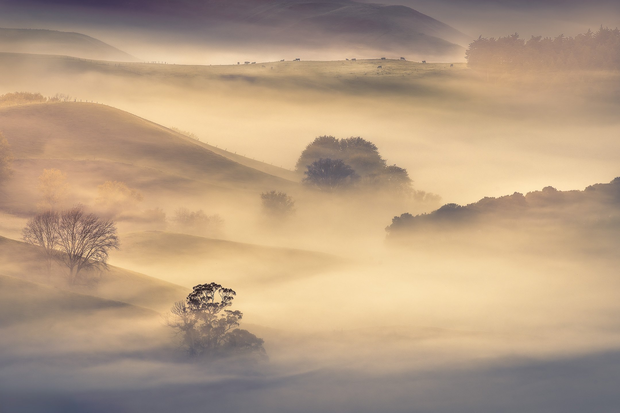
A peak at the fog
Surveying the white blanket of fog from Te Mata Peak at sunrise.
Mist and fog are a common feature at Te Mata Peak, especially outside the dry summer season. The view from Te Mata Peak usually features the Tukituki river flowing towards the bay. On the day this photo was taken, the morning fog was obscuring the river.

Fog in the Tukituki Valley
I usually feature the peak in shots taken from this area. But on this day, the flow and glow of the fog were beautiful enough on its own.

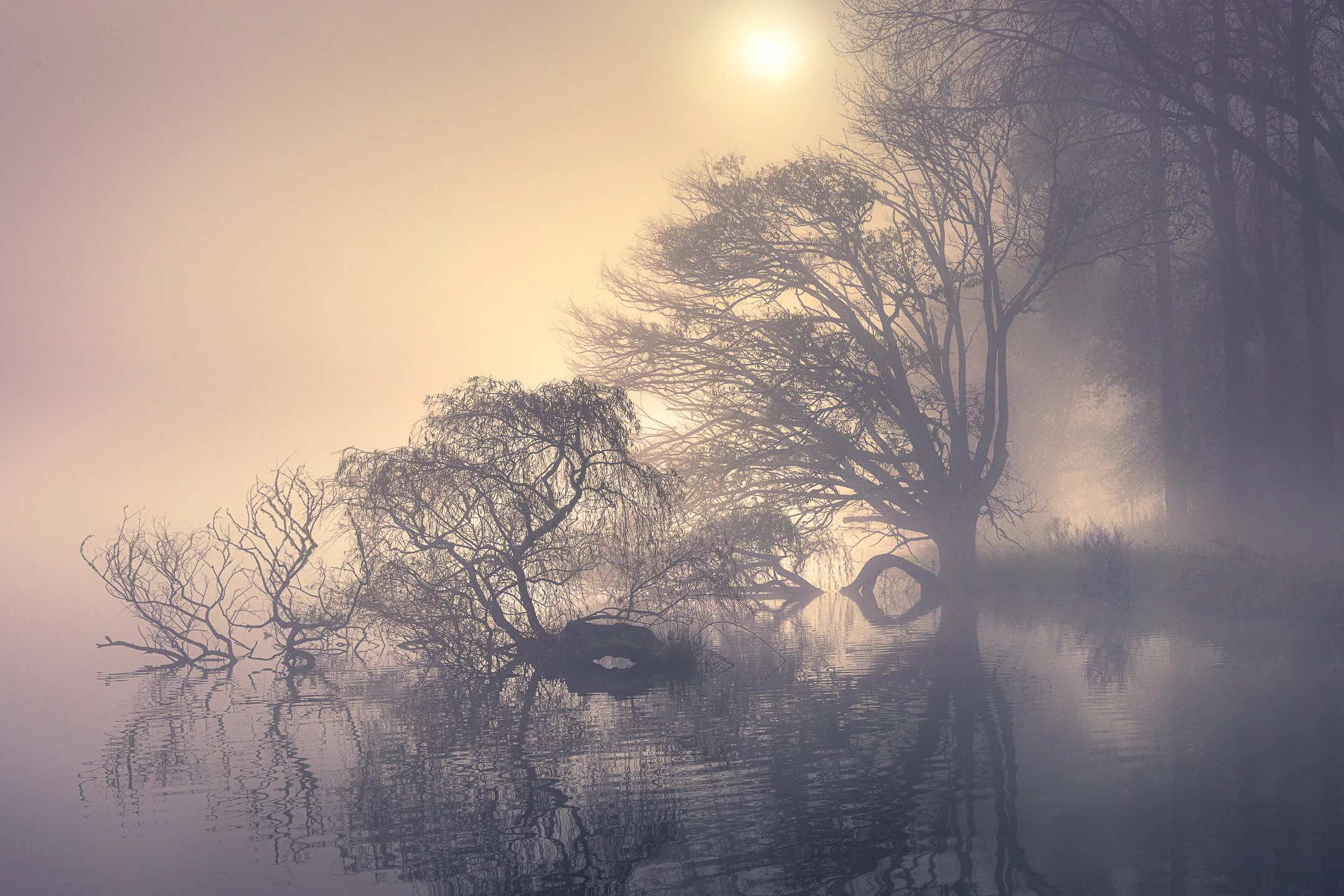
Tree and Morning Mist
This photo was taken from the top of Te Mata Peak. As a local, I visit this area regularly, and on the morning this photo was taken, I was welcomed by thick mist flowing through the valley below. Initially the visibility was minimal, but as the sun started to rise, the mist gradually disappeared and added a touch of mystery to the hills and trees at the foot of the peak.
This image was selected by Flickr as one of the top 25 photos of 2020.

Brief moment of light
The sun briefly came through on this cloudy start of the day and lit up the valley directly below.

Red Flowers and Green Hills
The surroundings of Te Mata Peak are predominantly covered in grass that are happily grazed by sheep. Springtime briefly reveals a few flowers and I was lucky to spot these red ones during a stormy sunrise.
The other side of the peak
While sunrise is usually the best time to visit if you’re looking to catch the first light on the peak, sunsets are pretty good too. Turning the camera around to face Mount Erin can provide great scenic views as well.

Peak Hour
Sometimes persistence pays off. I had been going up Te Mata Peak for a number of weeks with this shot in mind. But whenever I went, the sunset was never that great and the shot turned out quite average. Finally, a few weeks ago I got what I was hoping for; a fantastic sunset.
Luckily, I wasn't the only one wanting to admire the sunset from the peak, so it was quite busy with cars going up and down the narrow road. Ideal for light trails.
This photo is a blend of shots taken within a 20 minute time span. The scenery with Mount Erin in the background is a panorama that combines a series of bracketed shots to capture the dynamic range. The light trails were captured last using a 20 second long exposure to capture vehicles driving from the bottom of the frame to the top.
Want to buy a print of one of the images above?

Want to see more Hawke’s Bay photos?
More visual stories


I arrived expecting cold — not just physical chill, but a particular visual cold: an Antarctica of the imagination, reduced to white and grey. The Ross Sea had other ideas. What I found instead was gold settling across volcanic peaks, pancake ice that looked impossibly like Monet's water lilies, and light that refused to behave the way Antarctic light was supposed to. For one hour in McMurdo Sound, the continent became the warmest place I have ever been.