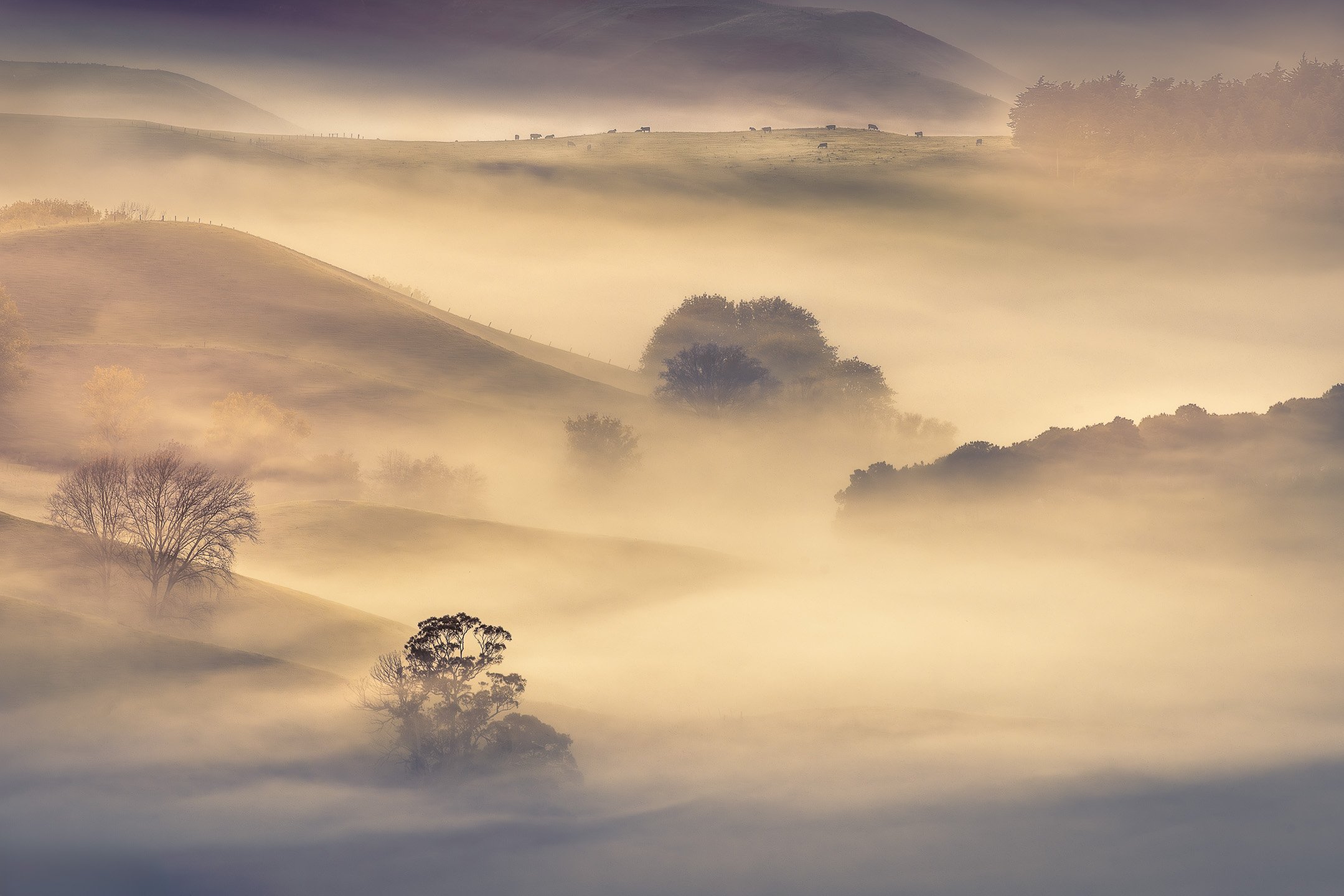
River of Fog
Finally, a misty Te Mata Peak! I have been taking photos here for many years now, but for some reason I was never able to capture a photo of the Tukituki Valley covered in mist from the top of Te Mata Peak. Until now.
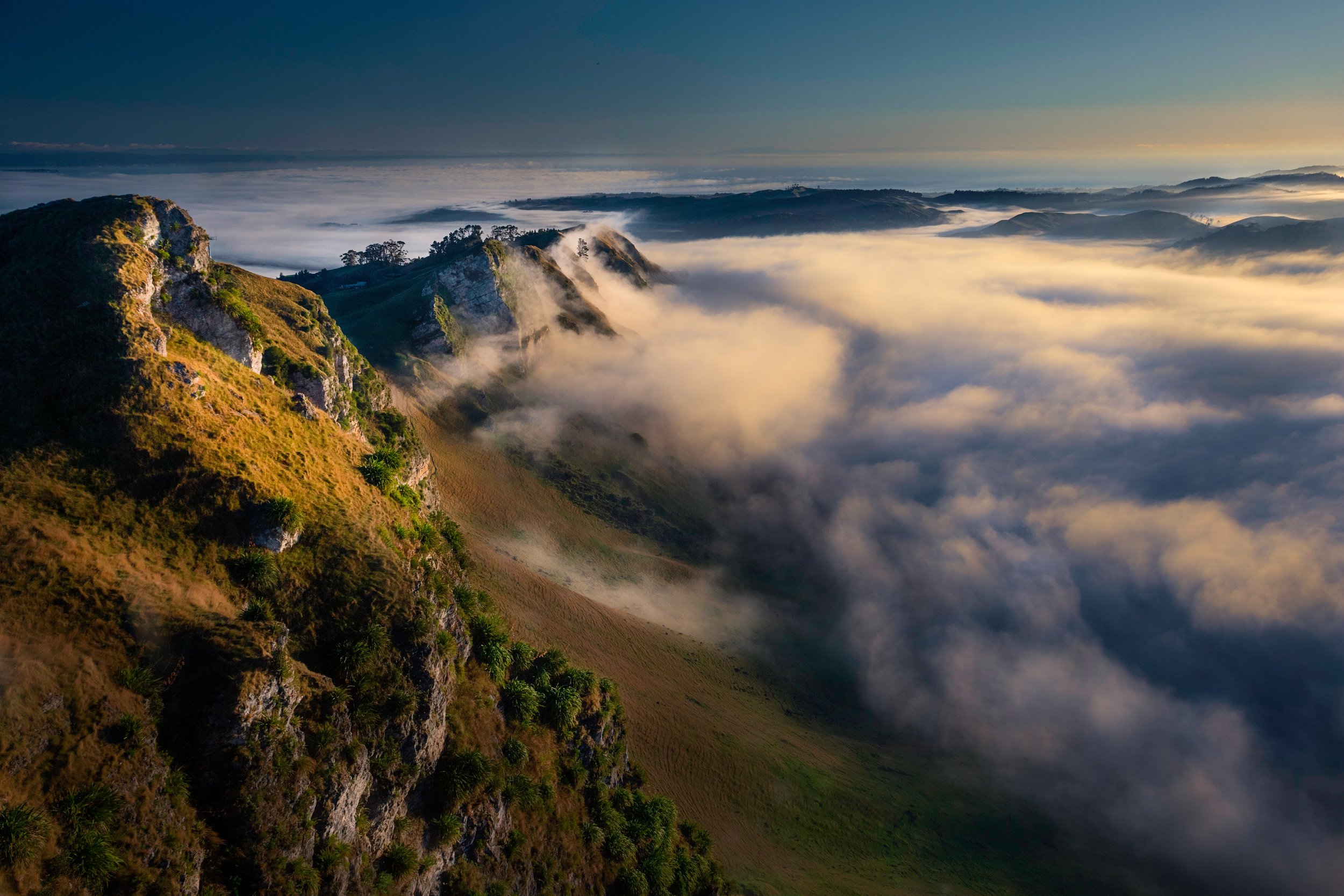
The view from Te Mata Peak usually features the Tukituki River flowing through the valley towards the bay. On the early morning these photos were taken, the morning fog was obscuring the river. In fact, a few minutes before these photos were taken, even the peak wasn't visible, and I thought I had to be satisfied with a moody long exposure of the rolling fog and a shot of Mt. Erin poking its head above the clouds.
Was this all I was going to see?
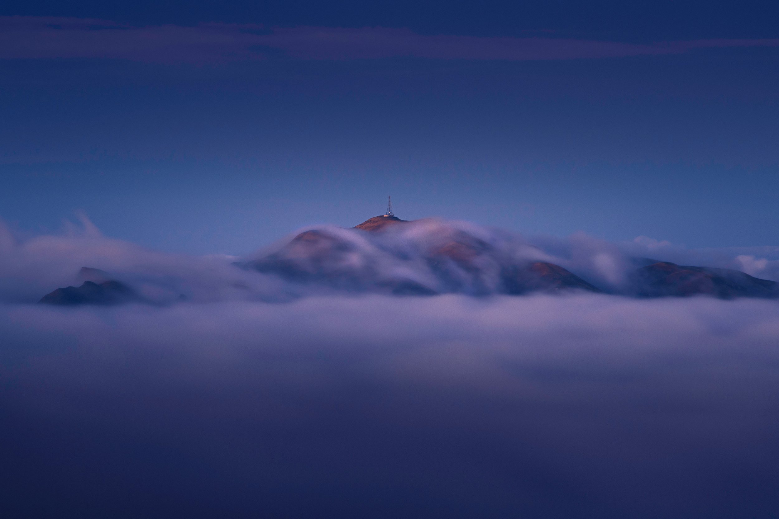
Mt. Erin above the clouds
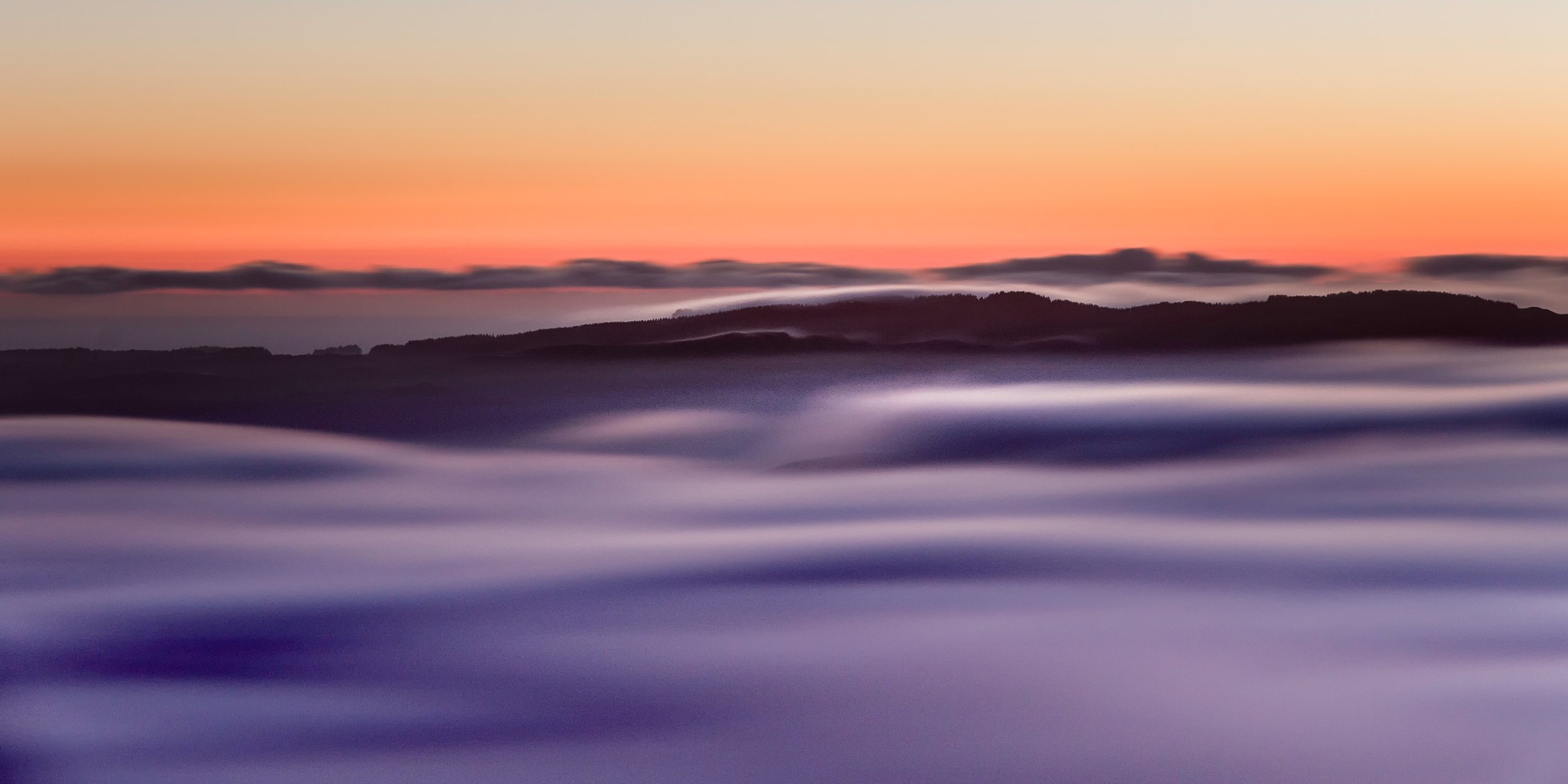
Rolling Fog as seen from Te Mata Peak
But luckily, the fog gradually gave way and exposed the mighty Te Mata Peak while the Tukituki river remained covered by this incredible river of fog.
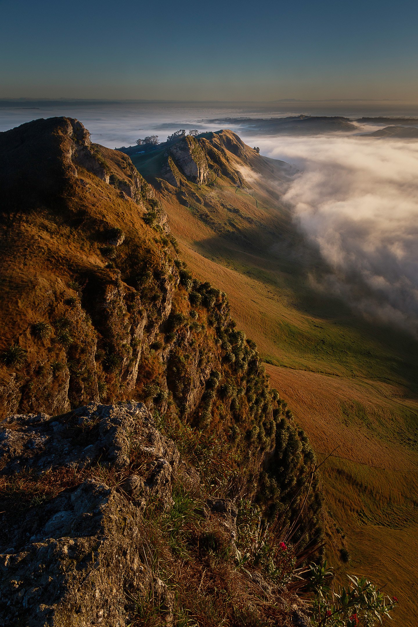
Receding Morning Fog
Morning fog climbing up the Peak
The view from Te Mata Peak usually features the Tukituki river flowing towards the bay. On the day this photo was taken, the morning fog was obscuring the river. In fact, a few minutes before this photo was taken, even the peak wasn't visible.
Gallery
Click on one of the images above to view in the lightbox.
More visual stories
In the Subantarctic, the landscape is never still. Wind, water, and shifting light reshape the islands from moment to moment, blurring the boundaries between land, sea, and life.
This article explores a different way of seeing—where the landscape is not a fixed scene, but a living system in motion.
In 2025, my photography captured New Zealand’s landscapes, from misty forests to rugged coastlines and mountains. Balancing travel with familiar local scenes, these images reflect both place and personal experience, telling a quiet, honest story of the year in photographs.
A visual story of a photography trip to Cape Farewell including a sunrise and sunset at Wharariki Beach, a hike on top of the cliffs, and an exploration of Farewell Spit.
Over several mist‑filled mornings below Te Mata Peak, I set out to capture more than just the view — I wanted to express the quiet mood and shifting light of the Tukituki Valley. This series presents images with a more interpretive approach, revealing the beauty, atmosphere, and subtle rhythms of Hawke’s Bay in golden light.
An itinerary with photos, gear tips, and a personal account of a 3-day hike of the Routeburn Track, one of New Zealand’s most scenic Great Walks.
This visual journey follows Northland’s Twin Coast Discovery Highway, taking you through the Kauri Coast to the Far North, before returning via the Bay of Islands to Whangārei. Travelling in our motorhome, we dedicated two weeks to thoroughly revisit familiar spots and uncover new ones.
Step into the serene beauty of Lake Tūtira, where a foggy morning and tranquil waters set the stage for magical reflections and unexpected inspiration. Discover how this 36-hour retreat turned into a photographer’s dream!
A visual story about a group of recurring trees in the rural fields of Hawke’s Bay that are a recurring photography subject for Jos Buurmans. View his images and learn why revisiting the same location could help your photography.
The Balleny Islands sit at one of the most extraordinary geographic boundaries on Earth — the Antarctic Circle runs directly through the archipelago. On the way south, they were barely visible through cloud. On the return, two weeks later, they gave me everything: fierce light, sculptural icebergs, and a moment of golden revelation I could not have predicted or planned for.
Wild light. Monolithic ice. And an arch worn through the body of an iceberg that remains one of the most astonishing things I have encountered in a lifetime behind a camera.